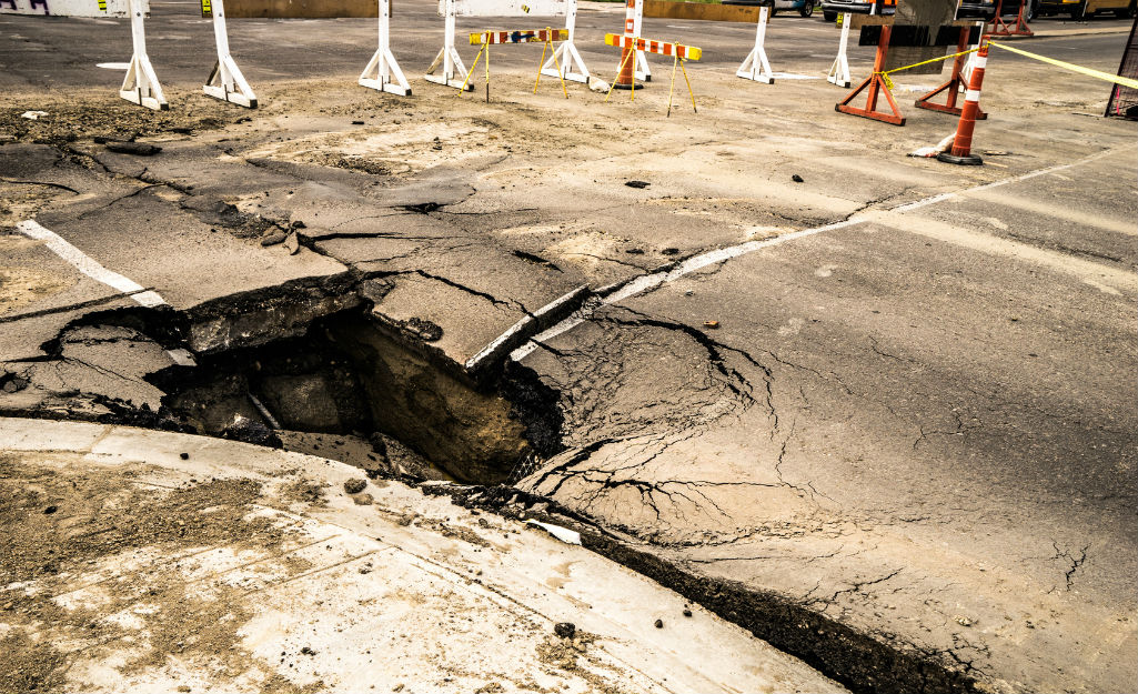
One way that sinkholes form is when water in the atmosphere reacts with carbon dioxide and forms a weak carbonic acid. As the slightly acidic rainwater moves through fissures in the limestone, it begins to dissolve and widens the fissures—which eventually creates air or water filled pockets. When those pockets become expansive, they’re called “caves” or “voids.” This is a common natural phenomenon in limestone or dolomite known as karstification—but it can be dangerous, expensive, and life-threatening when the ceiling of a void weakens and caves in. This is known as a “sinkhole.”
At large developments and building sites, knowing whether or not you’re sitting on a karst area—an area with a high density of fractures, solution channels, and caves formed in limestone and thus, possible sinkholes—is critical and can greatly affect the value of the land. In this article, we’ll discuss how to identify a sinkhole (including sinkhole detection and the most common signs of sinkholes), sinkhole inspection, and what to do once you’ve discovered a sinkhole.
Sinkhole Detection: The 7 Most Common Signs Of Sinkholes
Not all sinkholes provide surface expressions before opening up—but many do. And it pays to be aware of the most common indicators that your property may be situated right above a sinkhole!
Here are the most common seven signs of sinkholes:
- A round circular depression in the earth.
- Localized subsidence or depression anywhere on the property. In other words, an area that has dropped down relative to the surrounding land.
- A circular lake, as this can be indicative of a sinkhole that has opened up and been filled with water.
- A foundation settling—if part of the structure starts dropping down and cracking, this could be a sign of a sinkhole forming under a house or building.
- Cracking on roads or pavement.
- A sudden drop of well levels on a site, as this could be indicative of a sinkhole opening up and changing the water table beneath the site with no surface expression.
- A small opening in the ground that rainwater seems to disappear into.
Note: If you know that you are building in an area with karst terrain that is sinkhole-prone—for example, if you’re in Florida, Texas, Alabama, Missouri, Kentucky, Tennessee, or Pennsylvania—there is a far greater likelihood that you may have to deal with this issue in the future. Thus, it is wise to take a look around your property and the area in general for one of the seven signs of sinkholes listed above.
Sinkhole Inspection: How To Test For Sinkholes
If you identify signs of a sinkhole at your site, you’ll have to test the area to see what kind of karst area or sinkhole you’re dealing with. To do so, you’d set up several electrical resistivity survey lines over the site, image the target area, and look for high resistivity areas. These areas could indicate an air-filled void that hasn’t yet caved in but will likely continue to subside.
If you find a void during your geophysical survey, you can also dramatically cut down on the cost of drilling, as it provides a more precise drilling target with a much higher success rate. If the area you image has a soil layer over the limestone—both of which that show up well in the data—and then a pocket with very high resistivity, you’d certainly want to drill into that and see what you’re dealing with.
Do you need to conduct an electrical resistivity survey?
If you’re trying to determine whether or not there’s a sinkhole beneath your future construction site, conducting a resistivity survey is an effective way to determine the best course of action.
Advanced Geosciences Inc. (AGI) is the leading developer and manufacturer of geophysical imaging systems. Since 1989, we’ve been producing state-of-the-art electrical resistivity meters and products for resistivity and induced polarization (IP) imaging. If you conduct your electrical resistivity survey using an AGI imaging system, our staff will be there to help you from start to finish with free technical support.
Ready to discuss your project?

