- Office Hours: M-F 8:30 AM - 5:00 PM
The Pump Station Dam was constructed in 1889 to supply drinking water to the City of Fayetteville, Arkansas. However, in 2024, it had long outlived its 50-year life expectancy. Even the most well-constructed dams have a life expectancy of 100 years. The cost of maintenance or renewal exceeded the expected future benefits. The city proposed dismantling the dam and restoring the river to its original winding path.
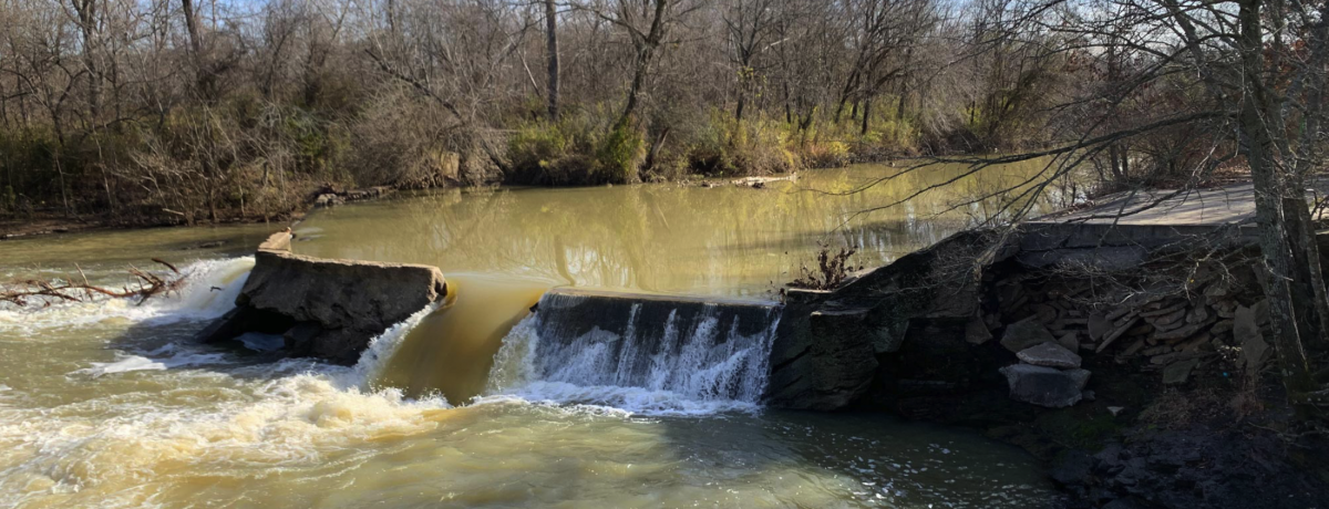
Sediment management is a primary challenge in dam removal projects. It significantly impacts the project’s budget, safety, and future river and dam site use. Once a dam is removed, the released sediments can affect the stability and erosion of riverbanks, leading to increased water turbidity. Therefore, estimating the sediment volume and assessing any related issues is crucial before initiating dam removal activities.
Since the river is 1 to 5 meters deep and has high banks, mobilizing a drill rig and barge was not feasible. As a solution, the departments of Civil Engineering and Geosciences at the University of Arkansas proposed conducting an Electrical Resistivity Imaging (ERI) survey as a cost-effective method to estimate sediment depth.
Three river sections were chosen for testing as these were the most likely areas to reshape the river. For each section, a line of 56 electrodes with 2 meter electrode spacing were placed, giving a total survey length of 110 meters.
Data was collected using an AGI SuperSting R8 wifi. The team used Dipole-Dipole, Strong Gradient, and Inverse Schlumberger arrays to collect data. Contact resistances were below 2000 ohm-m and generally below 500 ohm-m. Electrode elevations and water depth were measured using an RTK GPS.
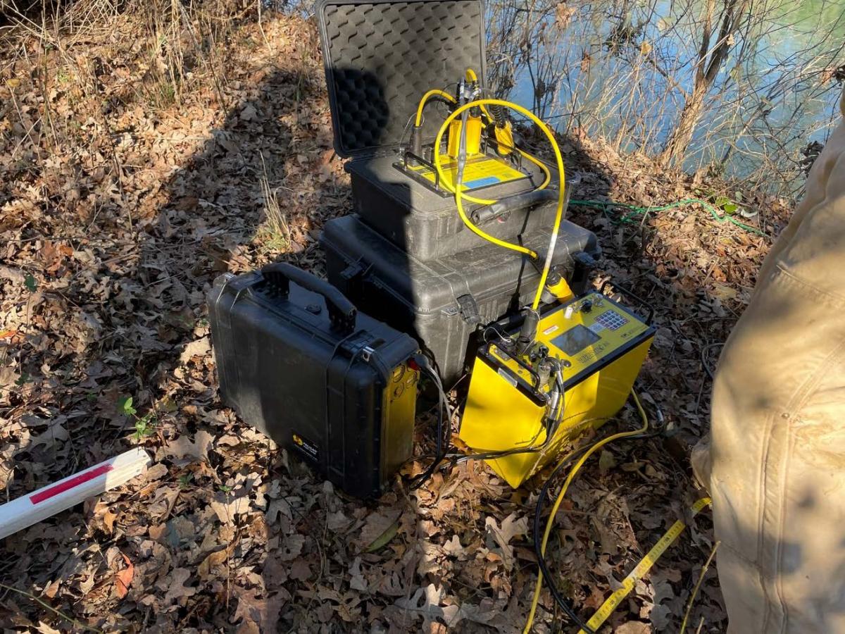
For each survey, the array started on the East bank and continued across the river and over the west bank. Both a small boat and a canoe were used to deploy the cable across the river.
Five hand augers were conducted near the survey lines to compare borehole samples to the ERI data.
The data was inverted using AGI EarthImager™ 2D, and the RMS errors were less than 5% with no data removed.
Boring logs and field observations were used to validate the survey’s results. Based on the interpretation of the results, the team found that there are low-resistivity layers near the surface close to the riverbanks. These layers mainly contain fine-grained soils and may be vulnerable to erosion and instability if the dam is removed. The bedrock elevation is much deeper, closer to the dam, with sediment thicknesses of over 10 meters along the banks and around 3 meters in the channel.
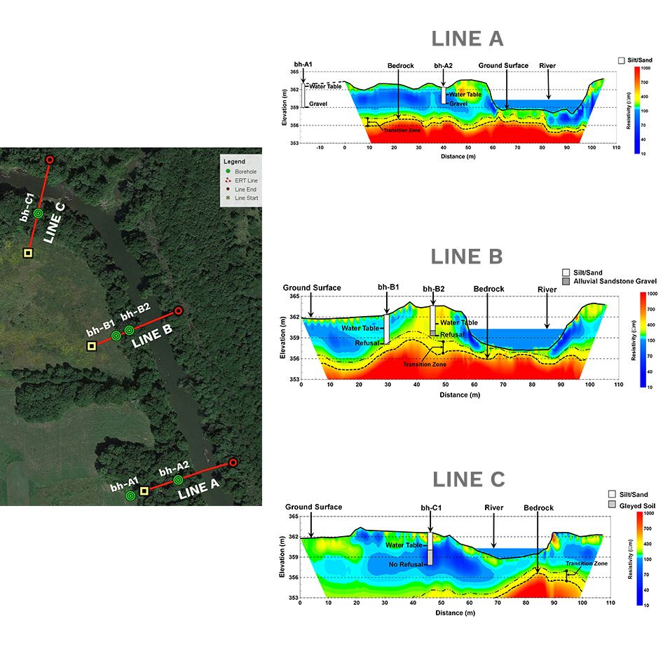
The depth of the soil layers resolved in the ERI cross-sections matched well with the boring logs, confirming that the ERI method can be a valuable tool for estimating the sediment depth in dam basins. This initial result can be used with additional field measurements for better sediment management for the project.


